
4-Band GeoTiff
When a geotiff is chosen as the delivered file format, the imagery is provided in four bands. These bands include the following channels: red, green, blue, and near infrared.
Most GIS applications can show only 3 bands at once and by default will present the natural colours (Red, Green and Blue).
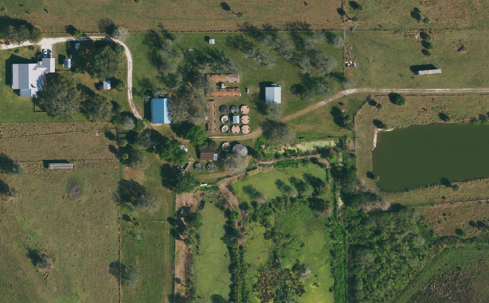
Example 1: Natural Colour of Delivered GeoTiff
A GIS user is able to display an image as colour infrared by changing the displayed channels.
Colour Infrared
To display colour infrared (CIR), A user can configure the following channel setting
Red: Channel 4
Green: Channel 1
Blue: Channel 2
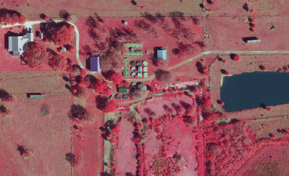
Example 2: Coloured Infrared Delivered GeoTiff
What are some applications of CIR
Forestry: Forest management/mapping, forest/tree health, tree classification, forest fire re-growth monitoring, and deforestation monitoring.
Agriculture: Assess vegetation health, address issues and increase yields.
City Management: Insights for vegetation management, urban forest analysis, land use studies, parks and recreation management, and analysis of pervious versus impervious surfaces.
Utilities: Utilities use CIR imagery to monitor and manage vegetation encroachment along powerlines and pipelines.
Environmental Science: Environmental studies rely on CIR imagery for wetland delineation, stream and river erosion delineation, invasive species monitoring, vegetation classification, and land use/land cover mapping.
For more information please read our blog: https://blog.hxgncontent.com/impact-of-color-infrared-photography-and-color-infrared-images/