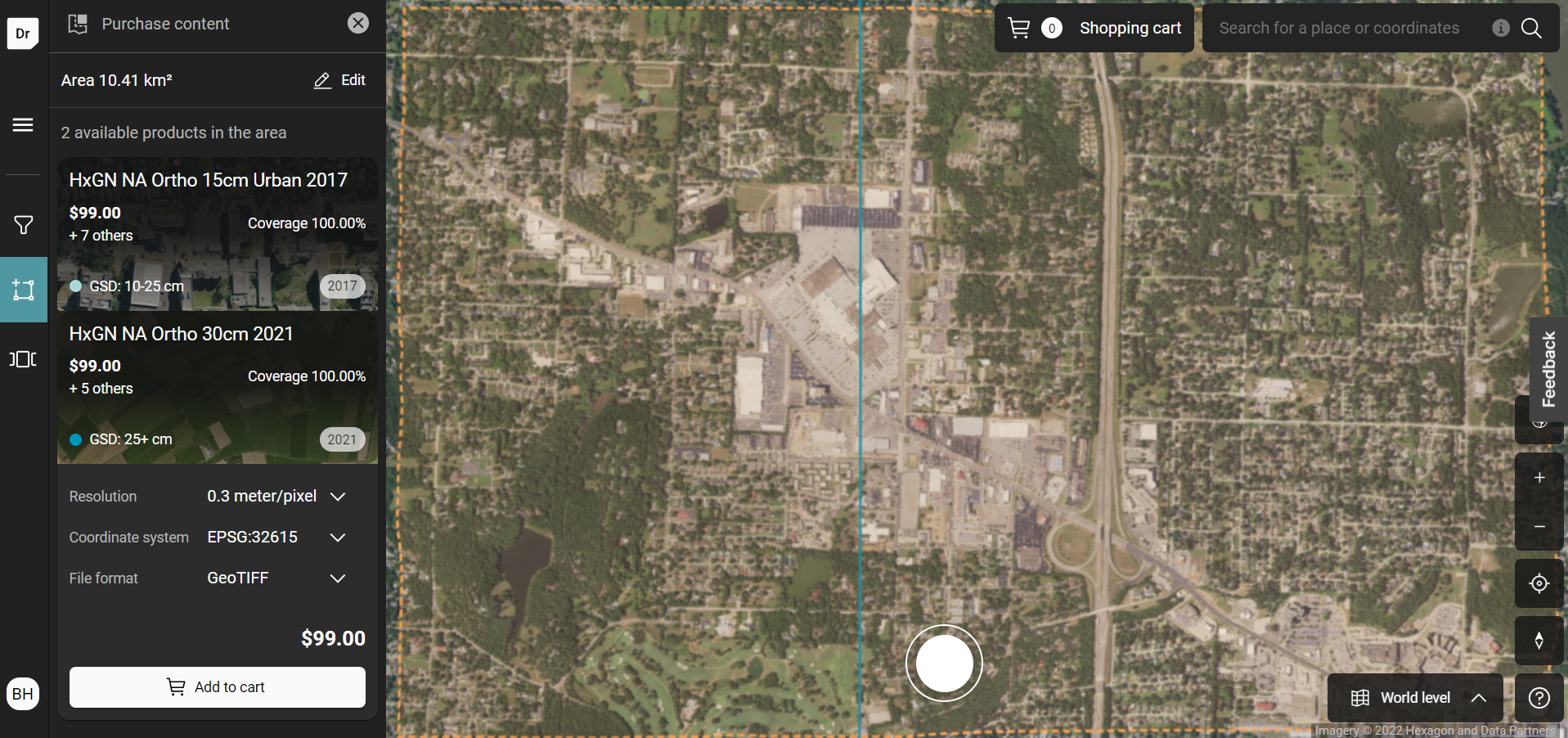
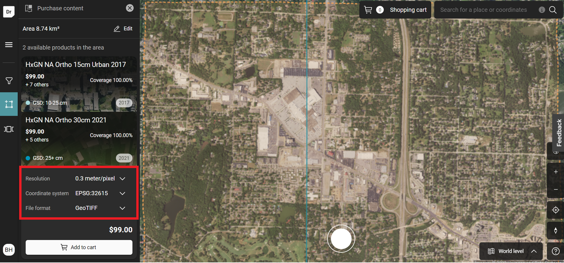
Purchase Options
Option | Description |
|---|---|
Data Layer | The HxGN Content Program offers many aerial data products, each with their own native resolution or point density. Some 4-band orthoimages are delivered as separate RGB and CIR files. |
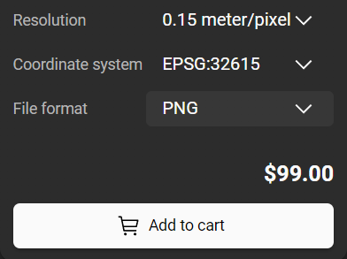
Coordinate System | Each product will have a variety of different coordinate systems, which are coded by their EPSG codes. If you are unsure which code matches your project, use https://epsg.io/ to search for the description of the EPSG code. |
Resolution | A data product’s native resolution will be the best resolution, but we offer customers the option to downsample the resolution as a cost-effective option. |
File Format | The default file format is recommended for our data products, but you can choose different formats including JPG, PNG and GeoTIF. For JPG and PNG formats, the georeferencing data is contained in the world files (JWG and PWG files respectively). For GeoTIF, the georefrencing data is contained in the header of the TIF and in the TFW file, which is not necessary to include in your application. |
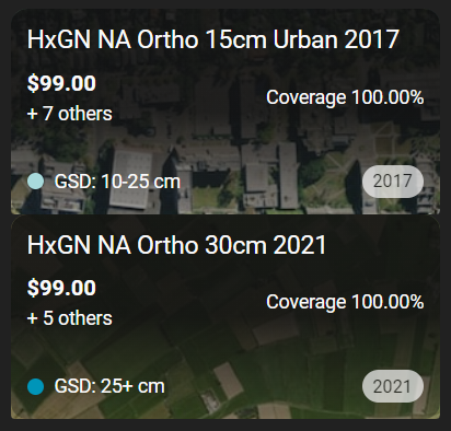
Multiple Data Layers
Some area may have multiple layers, these will be provided on the left panel. Each layer has it own purchasing option that can be selected and add to the cart.
Once added, the layer will show “item already in cart” to indicate the selection has been added.
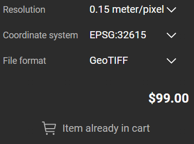
Please note that if any of the purchasing option is changed, the “item already in cart” will revert back to “add to cart” as this is considered a different product available for purchase.
Different product can be viewed by expanding the layer options of a selected product
Example 1: HxGN NA Ortho 15cm Urban 2017
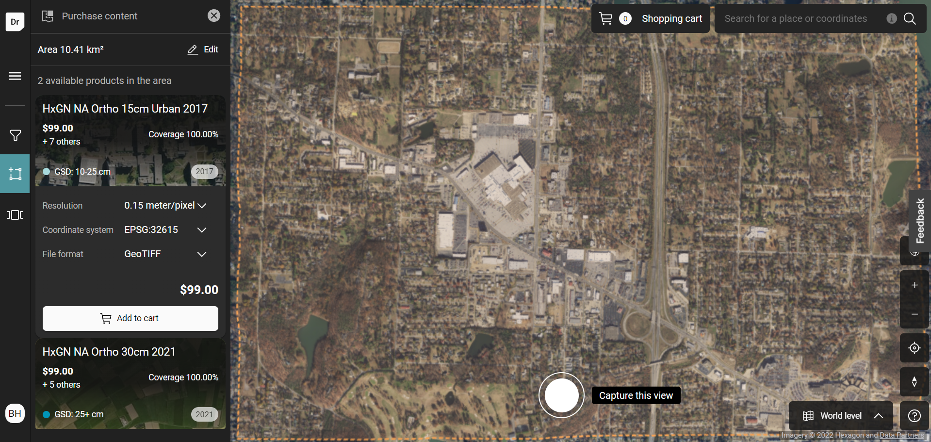
Example 2: HxGN NA Ortho 30cm 2021