Getting Imagery Metadata from ArcGIS Pro
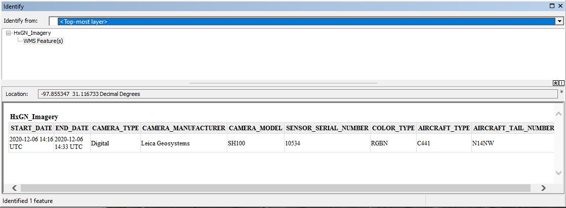
Most GIS applications will support the GetFeatureInfo function, which allows you to click any area of the map to view the metadata (if any exists).
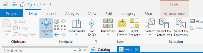
To access the GetFeatureInfo function, load the subscribed data layer using WMS, select the “Map” tab and click on “Explore.”
The metadata will be returned for the area you clicked.