Adding Aerial Imagery as WMS to ArcGIS Pro
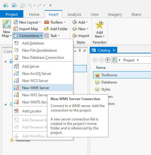
1. Navigate to Insert > Connections > New WMS Server.
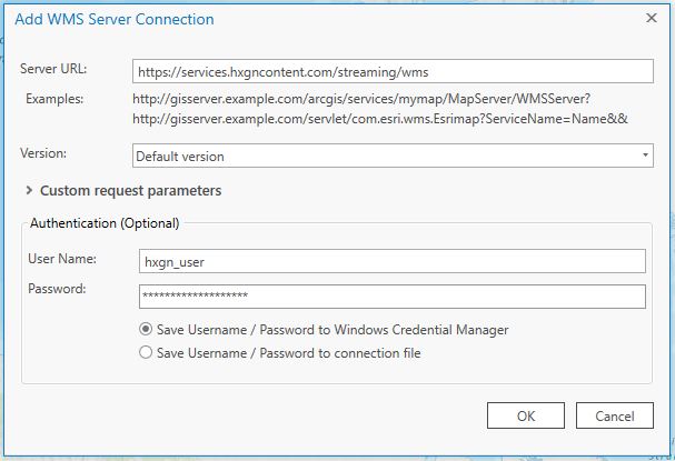
2. The Add WMS Server Connection window will open.
In the URL field, add the URL: http://services.hxgncontent.com/streaming/wms
Under the Authentication (Optional) section, fill in your username and password. If you want ArcGIS Pro to remember your password, select either “Save Username / Password” option. Click on “OK.”
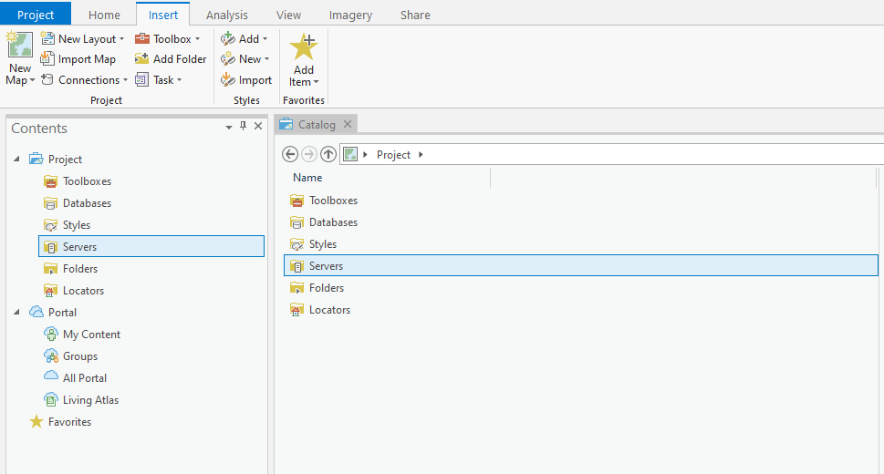
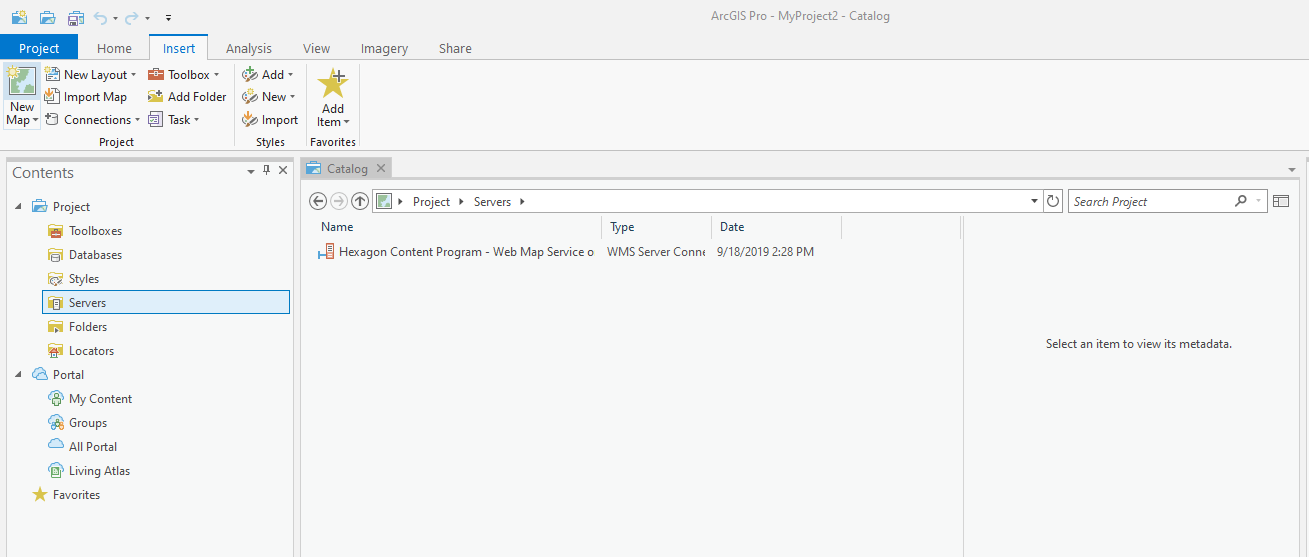
The connection to the streaming service has been made and is shown in the Catalog window under the Servers folder. Double-click on “Servers” to see the connection to the HxGN Content Program.
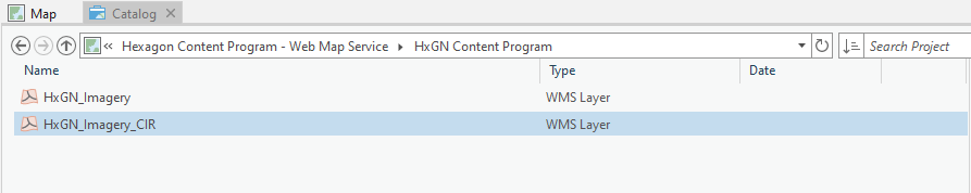
3. Double-click on “Hexagon Content Program – Web Map Service,” then double-click on “HxGN Content Program” to view your subscribed data layers.
4. Right-click on the layer you wish to add, and click on “Add to New” and then click on “Map.”