Getting Imagery Metadata from Global Mapper
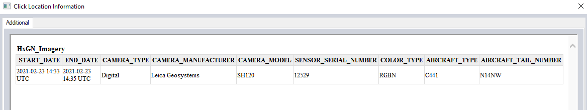
Most GIS applications will support a function called GetFeatureInfo. This function allows you to click any area of the map and be returned metadata (if any exists).
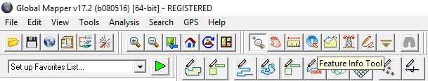
To access the GetFeatureInfo function, load the subscribed data layer and click on “Feature Info Tool.”
The metadata will be returned for the location you clicked.