Getting Imagery Metadata from ArcGIS Online (Classic)
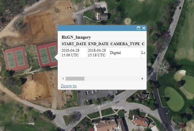
Most GIS applications will support a function called GetFeatureInfo. This function allows you to click any area of the map and be returned metadata (if any exists).
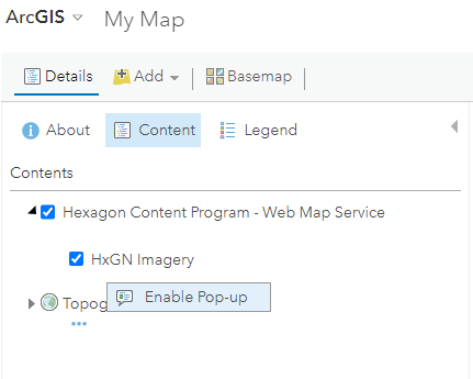
To access the GetFeatureInfo function, load the subscribed data layer using WMS. In the Content panel, select “Enable Pop-up” on the imagery layer.
Zoom into your AOI and select the map. The metadata will be returned for the area you clicked.