Adding Aerial Imagery to QGIS
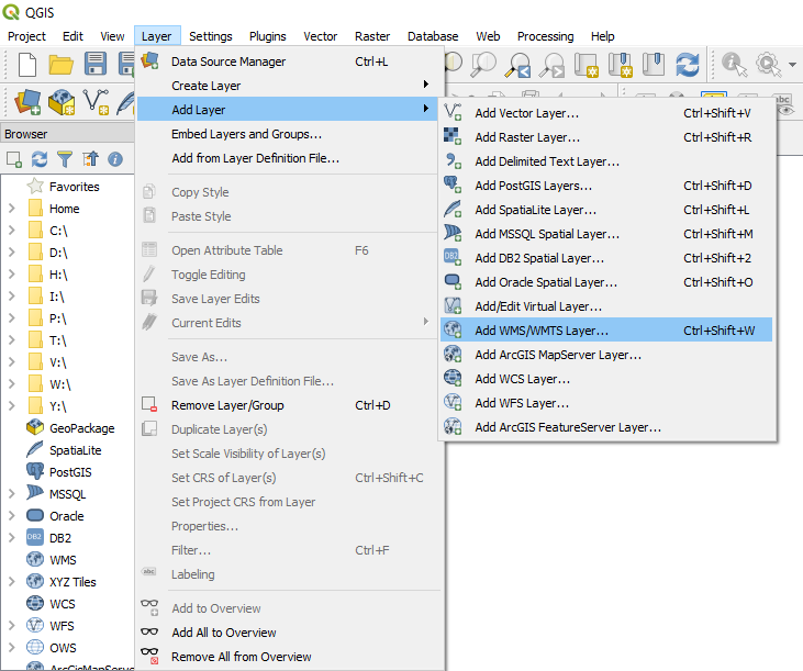
1. Navigate to Layer > Add Layer > Add WMS/WMTS Layer.
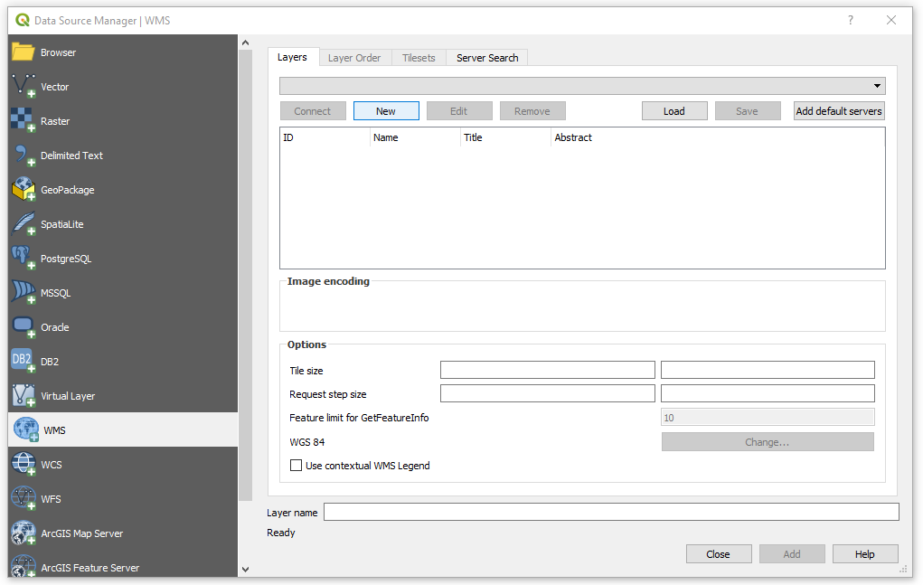
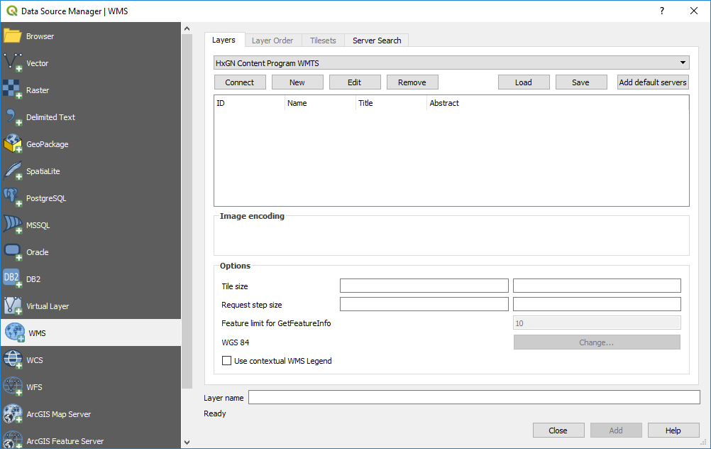
2. The Data Source Manager window will open. Click on “New.”
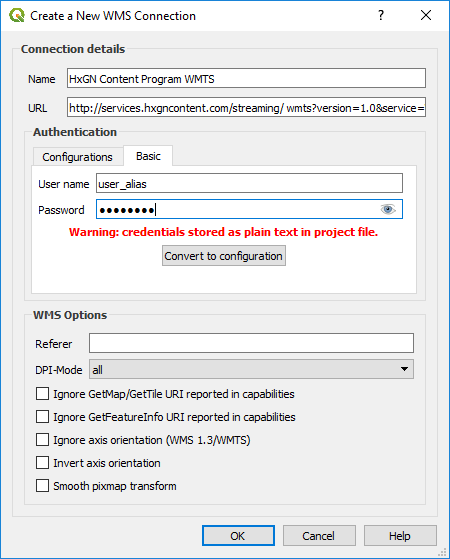
3. Once the Create a New WMS Connection window opens, complete the following steps:
Fill out the name of the connection
Add the URL:
http://services.hxgncontent.com/streaming/wmts?version=1.0&service=WMTS&REQUEST=GetCapabilitiesEnter your user credentials
Click on “OK”
The connection to the streaming service has been made, and you will return to the Data Source Manager window. Click on “Connect.”
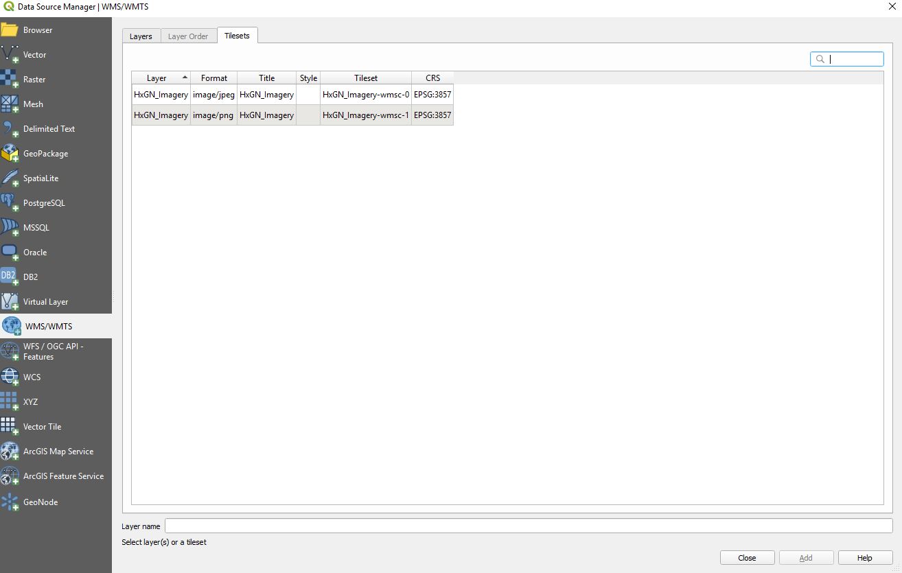
4. Click on the “Tilesets” tab in the Data Source Manager window to view available data layers. Highlight the layer you want to add, and click on “Add.”