Adding Aerial Imagery to ArcGIS Pro
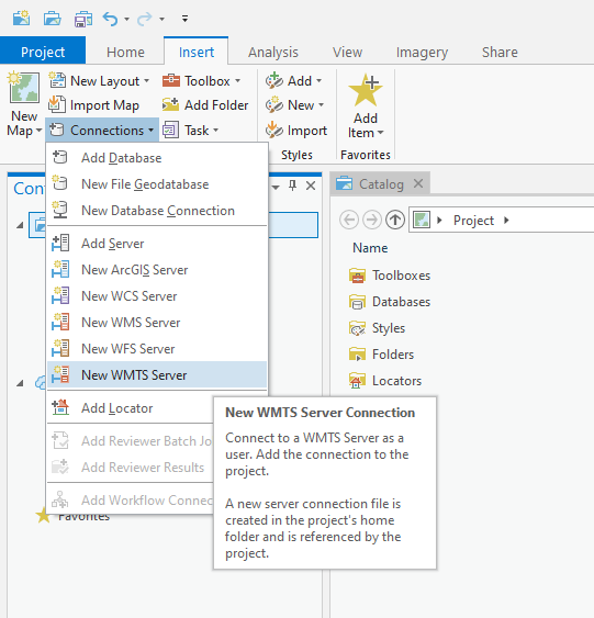
1. Navigate to Insert > Connections > New WMTS Server.
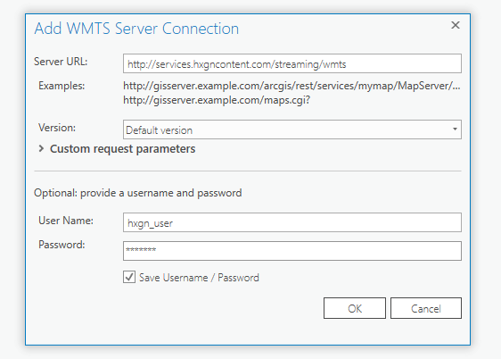
2. The Add WMTS Server Connection window will open.
In the URL field, add the URL: https://services.hxgncontent.com/streaming/wmts
Under the Optional section, fill in your username and password. Select the “Save Username / Password” box if you want ArcGIS Pro to remember your information. Click on “OK.”
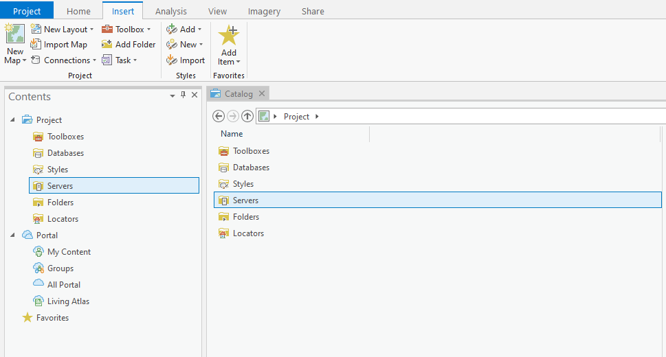
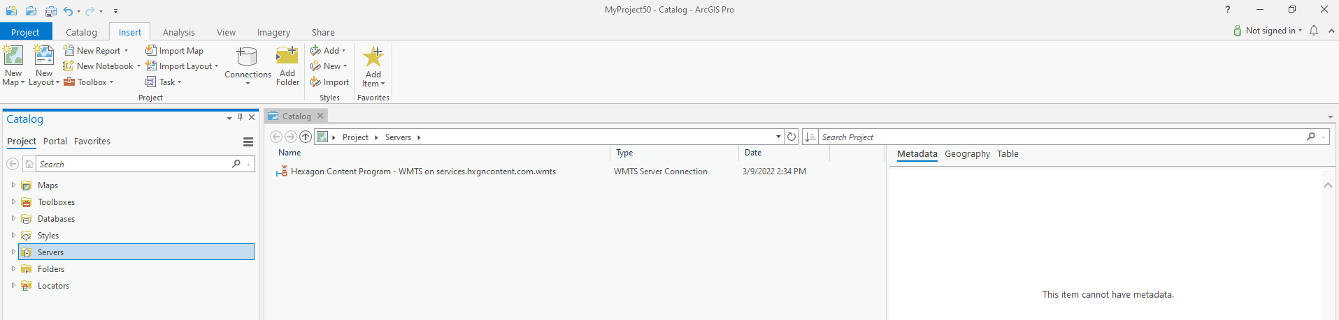
The connection to the streaming service has been made and is shown in the Catalog window under the Servers folder. Double-click on “Servers” to see the connection to the HxGN Content Program.
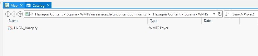
3. Double-click on “Hexagon Content Program – WMTS,” then double-click on “HxGN Content Program” to view your subscribed data layers.
4. Right-click on the layer you wish to add, and click on “Add to New” and then click on “Map.”