Adding Aerial Imagery as SOAP to ArcMap
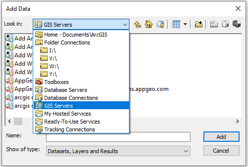
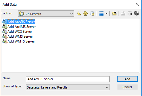
1. Click the “Add Data” button, or navigate to File > Add Data > Add Data.
2. Choose “GIS Servers” from the drop-down menu, and click on “Add.”
3. Double-click on “Add ArcGIS Server.”
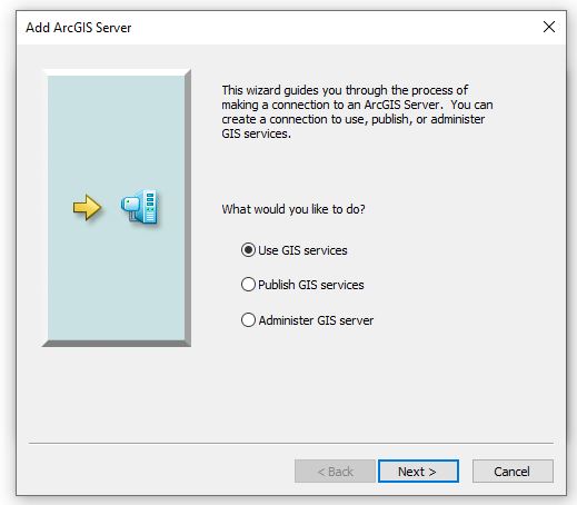
4. Select “Use GIS services,” and click on “Next.”
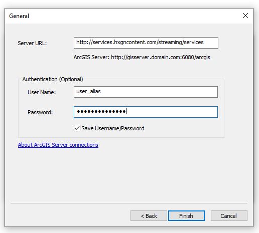
5. The General window will open.
In the Server URL field, add the URL: http://services.hxgncontent.com/streaming/services
Under the Authentication (Optional) section, fill in your username and password. Select the “Save Password” box if you want ArcMap to remember your password. Click on “Finish.”
The connection to the streaming service has been made and is shown in the GIS Server's location.
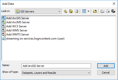
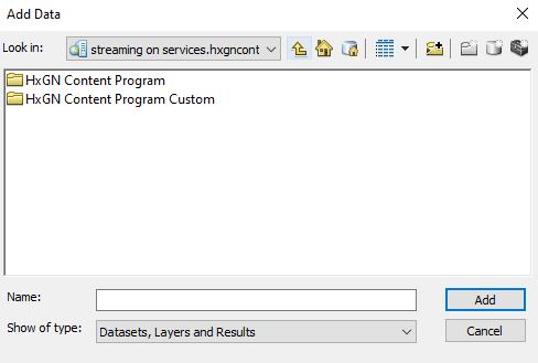
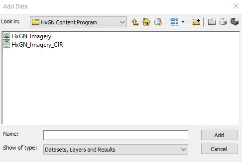
6. Double-click on the connection to view your subscribed data layers. Select the layer you wish to add, and then click on “Add.”